
26-28 Sep 2023 Santiago, Chile | Conferences and meetings of subsidiary bodies
The twelfth meeting of the Statistical Conference of the Americas of ECLAC will take place in Santiago, from September 26 to 28, 2023.
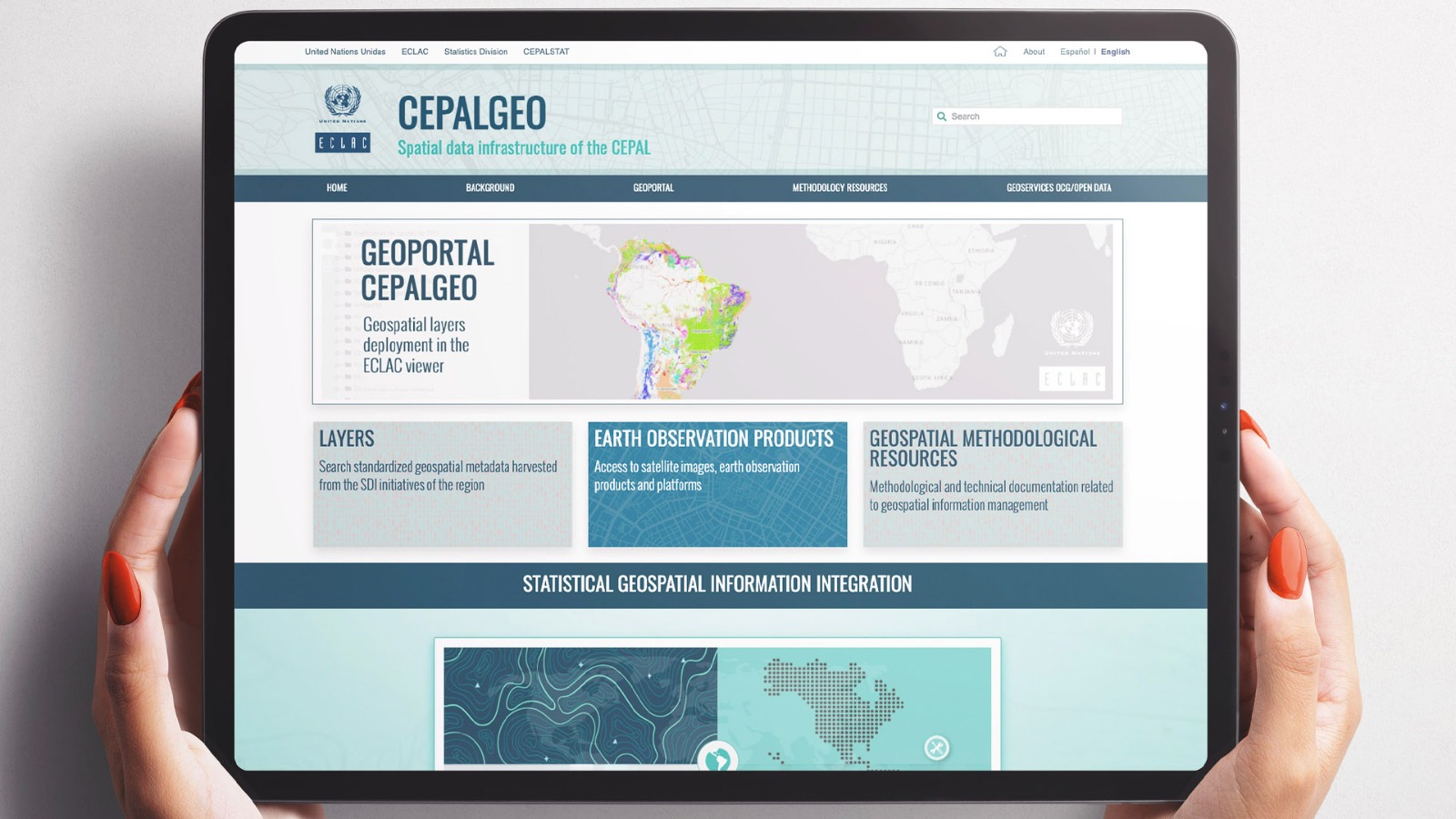
In the framework of the Twelfth Meeting of the Statistical Conference of the Americas, which is taking place on September 26-28 in Santiago, Chile, the Economic Commission for Latin America and the Caribbean (ECLAC) unveiled the new CEPALGEO platform, which seeks to strengthen geospatial knowledge in the region.
The use of georeferenced data and spatial analysis is increasingly common in the most diverse fields of study. The territorial dimension has earned an important place in decision-making processes and in the definition of public policies. This relevance has been manifested on the United Nations agenda through the creation of the Committee of Experts on Global Geospatial Information Management (UN-GGIM), which seeks to provide general guidelines for the management of geospatial information, mainly geared towards development and its social, economic and environmental dimensions.
Following these guidelines, and in a growing and sustained way, ECLAC has been incorporating geospatial data as a complement to statistical data to support the production of information and knowledge in their substantive areas. With the aim of facilitating the dissemination and use of this valuable repository, the Commission is putting at the community’s disposal its CEPALGEO platform, which brings together a series of resources aimed at strengthening geospatial knowledge both within the organization as well as in the region’s countries and other institutions.
Through the portal, users will be able to access a broad catalogue of geographic layers coming from various United Nations agencies, regional, academic and scientific institutions, and national governments along with resources prepared by ECLAC’s distinct divisions, facilitating integration and interoperability within a broad data ecosystem at a national, regional and global level.
CEPALGEO also presents geographic viewers, geoservices and links to ECLAC’s projects involving a territorial perspective on various social, economic and environmental issues. A critical section is the library of technical and methodological documentation that gathers the knowledge generated by international organizations and from the region’s countries, and which is a central input for the production and more efficient management of geospatial information and its integration with statistical information, using shared standards and procedures.
The platform is part of a form of organization that ECLAC has adopted regarding geospatial information management that is called SDI: Spatial Data Infrastructure. SDI, and its technological and institutional components, is consistent with the UN-GGIM guidelines: it allows for distributed resource management, ensures interoperability, and implements international standards throughout all processes.
26-28 Sep 2023 Santiago, Chile | Conferences and meetings of subsidiary bodies
The twelfth meeting of the Statistical Conference of the Americas of ECLAC will take place in Santiago, from September 26 to 28, 2023.


")